
Best Beginner Hikes in the Heart of Appalachia

Doable, Open to All

When people ask where to go hiking in Southwest Virginia, the answer depends on what kind of adventure they’re looking for. The Heart of Appalachia region in Virginia’s far west offers some of the most diverse and accessible hiking experiences in the state: from easy riverside walks and scenic rail trails to waterfalls, geological wonders, and rugged mountain routes.

But here’s the truth: hiking here is doable for everyone.

Whether you’re planning a quick afternoon outdoors, introducing your family to hiking, or preparing for a full-day adventure, these trails offer something for every pace and skill level. Visitors can choose trails with reliable parking and cell service or seek more remote landscapes where mountains, rivers, and forests create a true escape.

Below are the best easy hikes across Southwest Virginia, all rated green for beginner-friendly terrain. New to the region? Read the First-Timer’s Guide first.

Couple walking hand in hand on a blue-blazed forest trail surrounded by autumn foliage in Southwest Virginia

Photo Credit: VTC

Bring the Family, No Experience Needed.

This phrase, Doable, Open to All, is the exact promise of hiking in the Heart of Appalachia. Here’s what that means:

  • No experience necessary. You don’t need mountaineering skills or special training. Just show up with good shoes and a water bottle.
  • Family-friendly. Kids, grandparents, and everyone in between can experience these trails.
    Many have flat surfaces, shaded rest areas, and nearby facilities.

  • Accessible distances. Most trails listed here are under 5 miles, completing in 1–3 hours: perfect for a half-day outing.
  • Reliable infrastructure. Parking, restrooms, and visitor facilities are standard. You’re not hiking into the wilderness unprepared.
Four kids hiking a beginner-friendly forest trail in Southwest Virginia

The Heart of Appalachia believes outdoor adventure should be accessible to all. These trails prove it.

6 Easy Green-Rated Hikes Across Southwest Virginia

1. Powell River Trail: Appalachia, Wise County

The stone and brick portal of the Powell River Tunnel, a former rail tunnel now a walking and biking path in Appalachia, Wise County.

Distance: 3.5 miles  |  Difficulty: Easy (Green)  |  Time: 1–2 hours

If you’re looking for easy hiking with big scenery, Powell River Trail belongs on your list. This flat rail trail follows the beautiful Powell River through a peaceful valley. Along the route, hikers cross bridges and pass through one iconic tunnel: an unexpected adventure that’s memorable for all ages. As you exit the tunnel, you’ll spot a visible coal seam in the cliff face, a visual reminder of the region’s industrial heritage. Parking: Excellent. Cell service: Reliable.

Why it’s great: No elevation gain. River views. Unique tunnel experience.

2. Greenbelt Trail: Big Stone Gap, Wise County

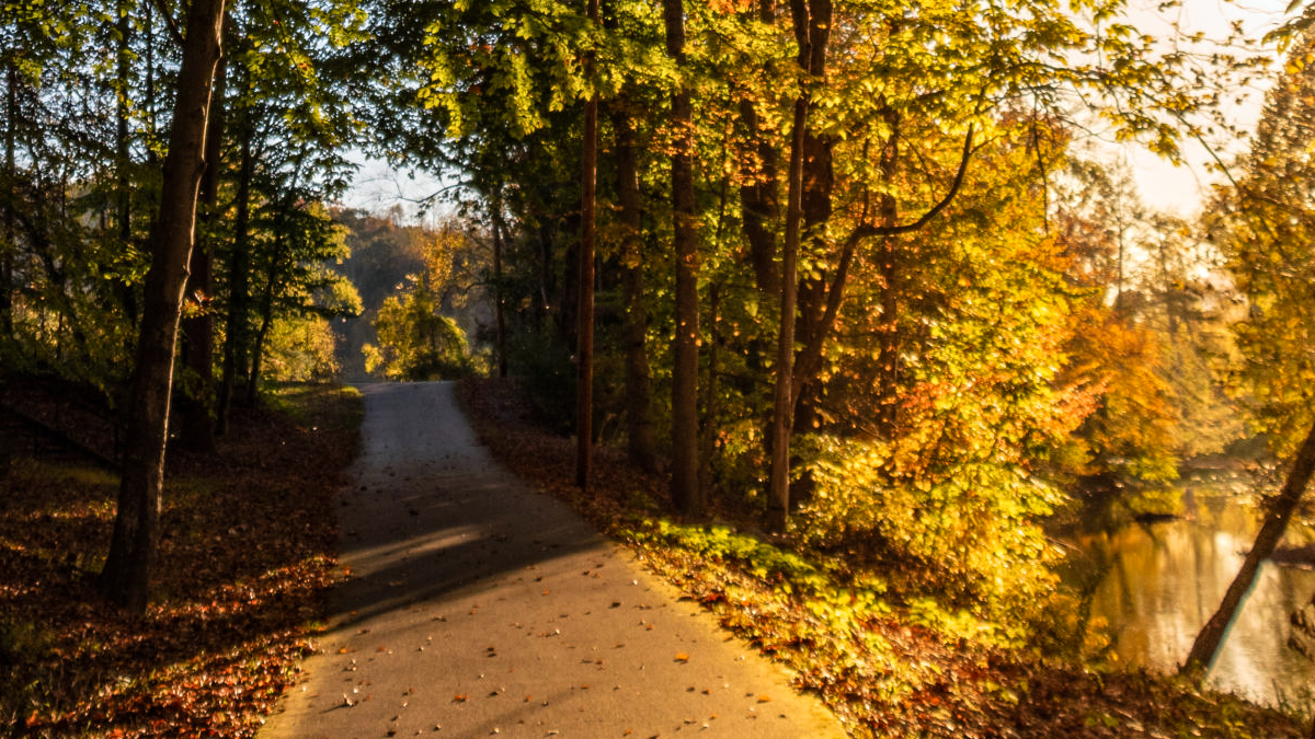
The paved Greenbelt Trail winding through autumn forest alongside the Powell River in Big Stone Gap, Wise County.

Distance: 4.5 miles  |  Difficulty: Easy (Green)  |  Time: 2–2.5 hours

Greenbelt Trail combines hiking with small-town exploration. This scenic route circles Big Stone Gap and follows the Powell River for much of the journey. Along the way, visitors can pair outdoor recreation with multiple local museums, town parks, and dining options, all within the 4.5-mile loop.

Why it’s great: Combines nature + town culture. Great for couples or solo travelers. Easy terrain.

Photo Credit: Ked Meade Photography

3. Lake Keokee Loop: Lee County

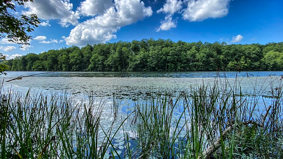
Calm summer view across Lake Keokee through shoreline reeds, with a forested far bank, on the Lake Keokee Loop in Lee County.

Distance: 3.7 miles  |  Difficulty: Easy (Green)  |  Time: 1.5–2 hours

For those who enjoy peaceful hiking trails, Lake Keokee Loop delivers quiet scenery and gentle terrain in a pristine national forest wilderness setting. This lakeside route offers a slower pace and opportunities to disconnect. Important note: No cell service. Download maps on your phone before heading out.

Why it’s great: Peaceful + scenic. Ideal for nature lovers seeking quiet.

Photo Credit: Missy Hawkins

4. Patriot Trail: Tazewell County

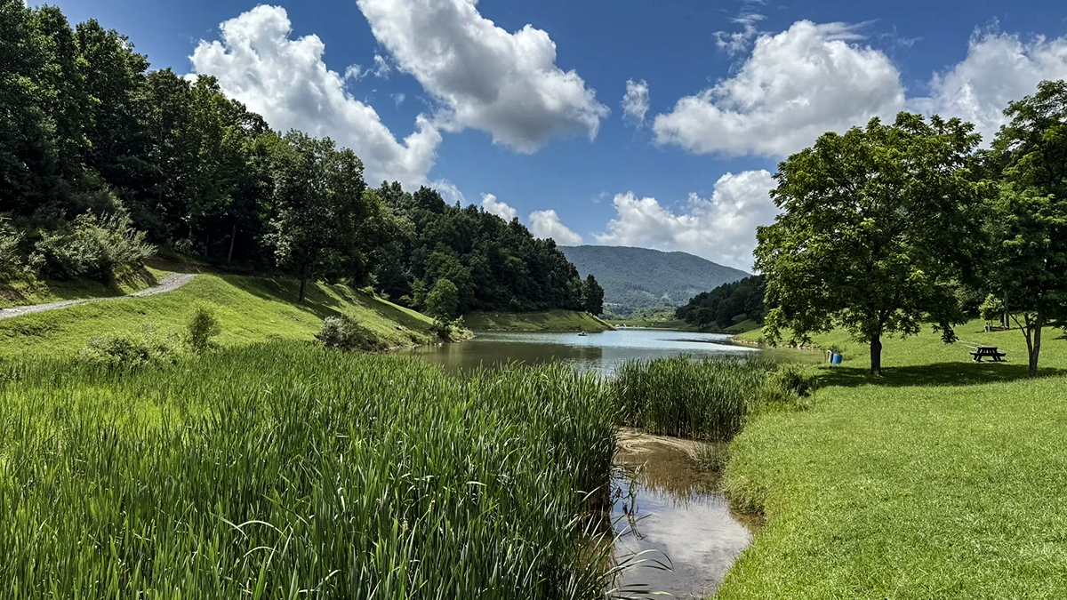
Scenic lake ringed by green lawn and forested ridges at Lincolnshire Park, along the Patriot Trail in Tazewell County.

Distance: 1.9 miles  |  Difficulty: Easy (Green)  |  Time: 45 minutes–1 hour

Located within Lincolnshire Park, Patriot Trail offers relaxed hiking around a scenic lake. The pea gravel pathway is well-maintained and connects to the Frank Barnes Trail extension for visitors wanting additional mileage while maintaining easy terrain. After your excursion, head to downtown Tazewell for dining options and an iconic sunset view of Deskins Mountain to the west.

Why it’s great: Shortest option (perfect for little legs). Lakeside scenery. Easy extension available.

Photo Credit: Scott Densmore

5. Sugar Hill Trail: St. Paul, Wise County

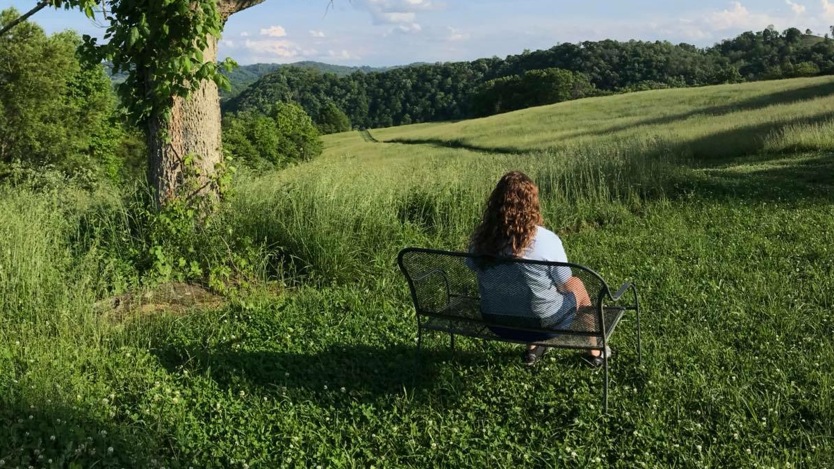
A visitor resting on a bench overlooking a rolling green meadow and forested ridges along the Sugar Hill Loop in St. Paul, Wise County.

Distance: 3.4 miles  |  Difficulty: Easy (Green)  |  Time: 1.5–2 hours

Sugar Hill Trail is a favorite for both hikers and cyclists. The gradual climbs and maintained trail surface make it an approachable route for visitors looking to enjoy mountain hiking without strenuous elevation. Perfect for introducing beginners to elevation gain in a controlled, manageable way.

Why it’s great: Good intro to elevation gain. Dual-use trail (hike or bike). Maintained surface.

6. JS Easterly Park Trail: Lebanon, Russell County

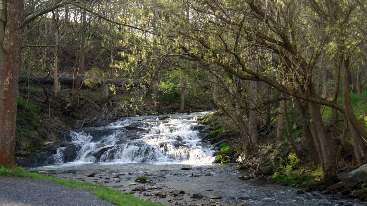
A cascading waterfall on Little Cedar Creek along the JS Easterly Park Trail in Lebanon, Russell County.

Distance: 1 mile | Difficulty: Easy (Green) | Time: 30 minutes

Not every memorable hiking experience requires a mountain. JS Easterly Park follows Little Cedar Creek and pairs an easy walking trail with playgrounds, picnic spaces, and recreational amenities. Ideal for very young children or anyone preferring a casual stroll.

Why it’s great: Shortest hike. Family amenities. Accessible for all abilities.

What to Bring on an Easy Hike

  • Proper footwear: Shoes with good grip (trails can be wet/muddy)
  • Water: At least 1–2 liters per person
  • Snacks: Trail mix, granola bars, fruit
  • Map or downloaded offline maps on your phone
  • Layers: Mountain weather changes quickly
  • Sunscreen: Even in shade, UV exposure is real
  • Insect repellent: Especially spring/summer
  • First aid kit: Small pack for minor cuts/blisters

Ready for Something Harder?

These six trails are just the beginning. Once you’ve conquered the green-rated hikes, you’re ready to explore:

Next level up: Check out Devil’s Bathtub Trail in Scott County: a scenic waterfall hike with creek crossings and a famous blue swimming hole. Still approachable for adventurous beginners, but with more technical terrain.

Want to see more waterfalls? The HOA Waterfall Trail connects seven spectacular cascades across the region.

Coming soon: our Ultimate Hiking Guide to the Heart of Appalachia, covering all difficulty levels across all seven counties.

Hiker with trekking pole following the forested creek along the Devil's Fork Trail toward the Devil's Bathtub in Scott County, Virginia

Photo Credit: Jeff Hess

Plan Your Hike

Ready to explore these trails? Use our free trip planner to build a day-hike itinerary across Southwest Virginia. Select which trails match your interests and distance preferences, and we’ll map your route, suggest nearby lodging, and recommend places to eat.

Keep Exploring

Coming soon: the Ultimate Hiking Guide to the Heart of Appalachia: every trail, every difficulty level.